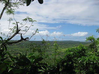
Sunday April 10 2011. We started our hike from the Marpo Well to Lion's Head at 10:30 AM. I have not gone to Lion's Head since Mr. Cole left Tinian.
 I downloaded coordinates from Mr. Cole's geocahing website into my GPS, which I had just bought recently
 There were many remains from WWII on the way to go Lion's Head, such as beer bottles, plates, pots and a lot of Japanese shelter were built on way to Lion's Head.
 After we went up on the cliff , we continued to hike South East. We found a red paint marker. It seemed to lead us Lion's Head. We took a rest and had lunch about 600 feet away from Lion's Head. It was already passed 1:00pm.
 We will return to Lion's Head by next week again. We are planing to hike with my friends who want to hike to Lion's Head.
 We could not find Mr. Cole's cache this time. It's seems to be gone.
By Mitch


